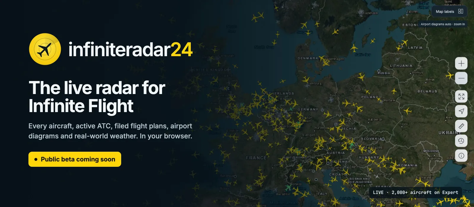
infiniteradar24 launches on 19 October
Hey everyone! For the past few weeks I’ve been building infiniteradar24, a live radar for Infinite Flight that runs in your browser. Think of the trackers you know from real-world aviation, rebuilt around the things we care about in the sim: Expert traffic, ATC, flight plans and the airports we fly into every day.
It opens to everyone on 19 October 2026 at 00:00 UTC at infiniteradar24.onrender.com. The countdown is already running:


 Launch news, bug reports and group flights on discord.gg/mh3fwqWzQZ.
Here’s a look at what’s inside.
Every aircraft, live
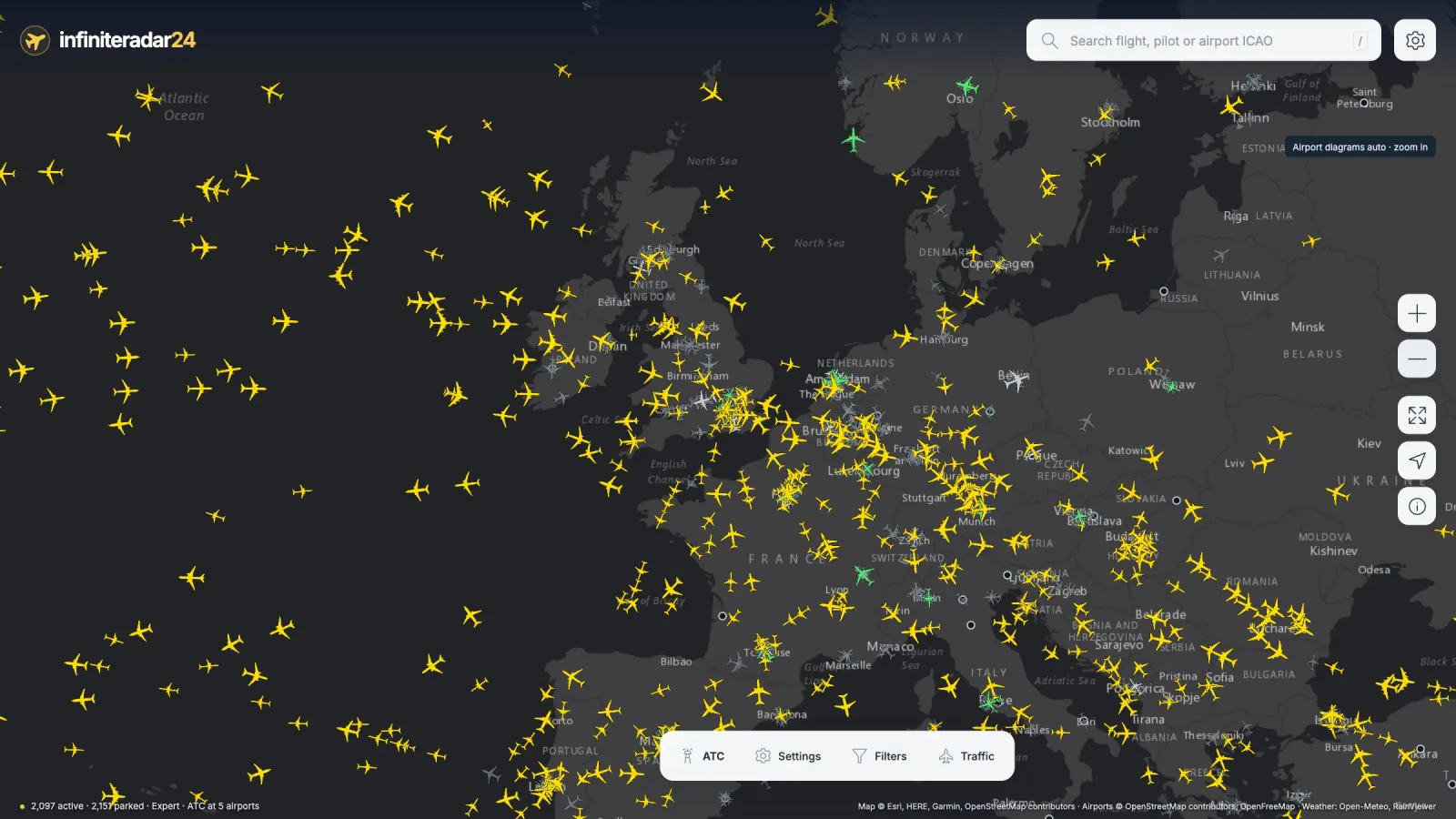
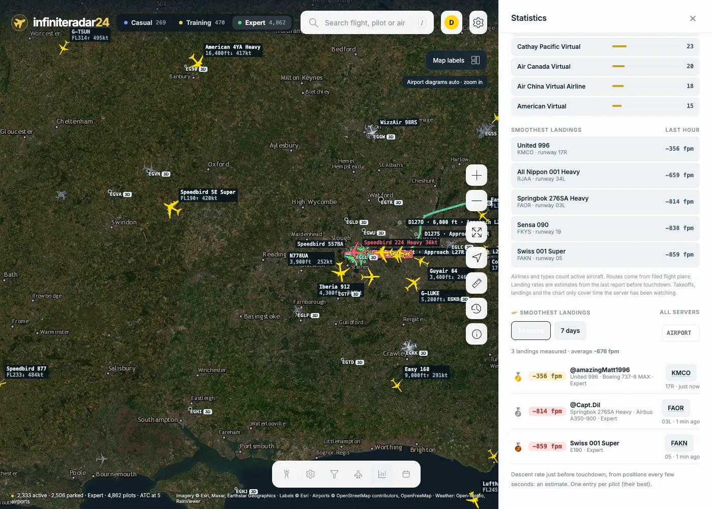
- All live aircraft on Casual, Training and Expert, drawn smoothly on one map. Panning stays fluid even with 4,000+ aircraft loaded.
- Detailed icons for each aircraft type, sized like the real thing (an A380 really looks bigger than a CRJ).
- Aircraft glide between updates and slow down realistically on landing, so they don’t jump around every 15 seconds.
- Parked aircraft are detected and dimmed, so the map shows who is actually flying.
- Radar-style data tags with callsign, flight level, speed and the airline’s logo, which never pile up on top of each other.
- Map styles: satellite, dark and light.
Flights: trail, flight plan, pilot
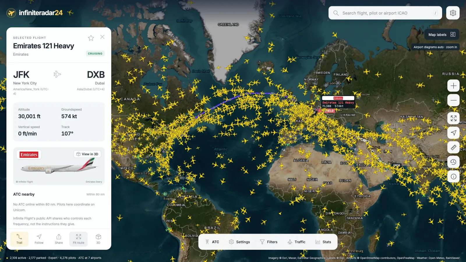
Tap any aircraft to open its card:
- Departure and arrival with local times, progress and an arrival estimate.
- The flown trail coloured by altitude, and the filed flight plan ahead of it with the next waypoint, distance to go and every SID, fix and approach in order.
- The aircraft, livery and airline logo, with the official Infinite Flight picture of that exact livery.
- Wind at the aircraft’s position, with the headwind or tailwind component.
- The pilot’s profile: grade, XP, flight time, landings, violations, and their most recent flights from the logbook.
- Star a pilot to follow them: you get an alert when they come online, take off or land.
ATC and airports
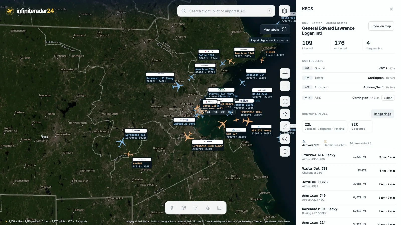
- Every staffed airport shows its open frequencies right on the map.
- Open an airport to see its controllers, live arrivals and departures boards (sorted by distance, with minutes to go), the ATIS (which can be read aloud), and active NOTAMs.
- Inbound and outbound traffic are highlighted on the map.
- Search for any airport by ICAO, IATA, name or city.
Zoom in, and the airport draws itself
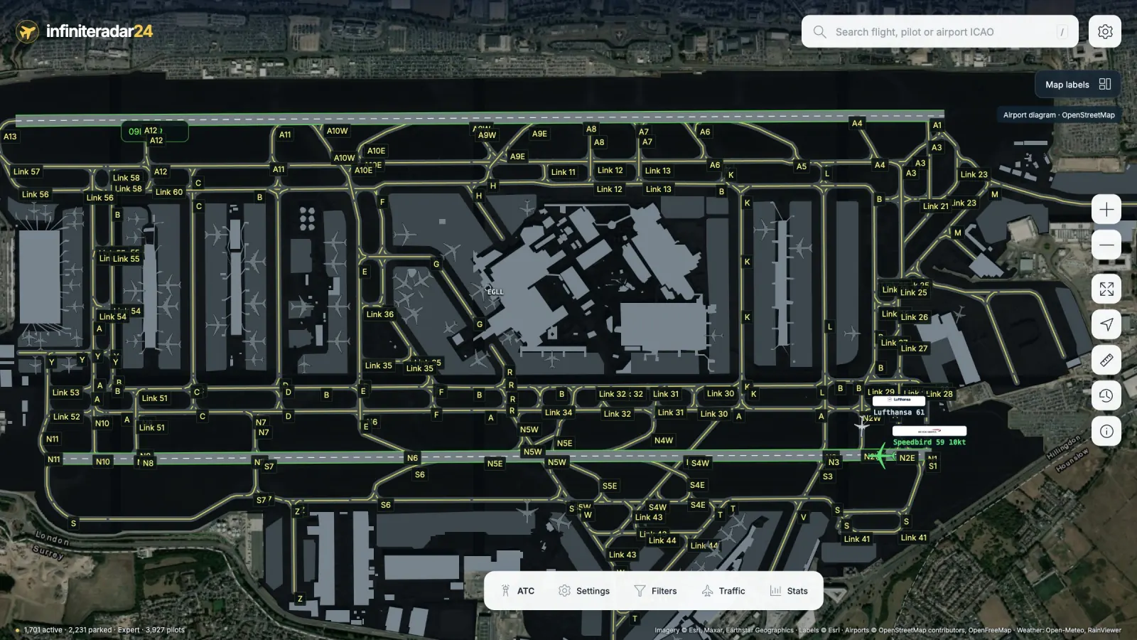
Runways, taxiways, aprons, stands and terminals appear as you zoom in, with taxiing aircraft in green. It’s perfect for watching a busy hub during an event.
Weather and more
- Real-world precipitation radar, day/night shading, and animated wind at the surface, FL100 or FL340. Infinite Flight’s live weather follows real-world conditions, so this is the sky you’re actually flying in.
- North Atlantic tracks with their flight levels, plus NOTAM and restricted areas.
- Filters for status, altitude, speed, aircraft type, airline, virtual organization and callsign.
New since the first look
Voice ATC at uncontrolled airports
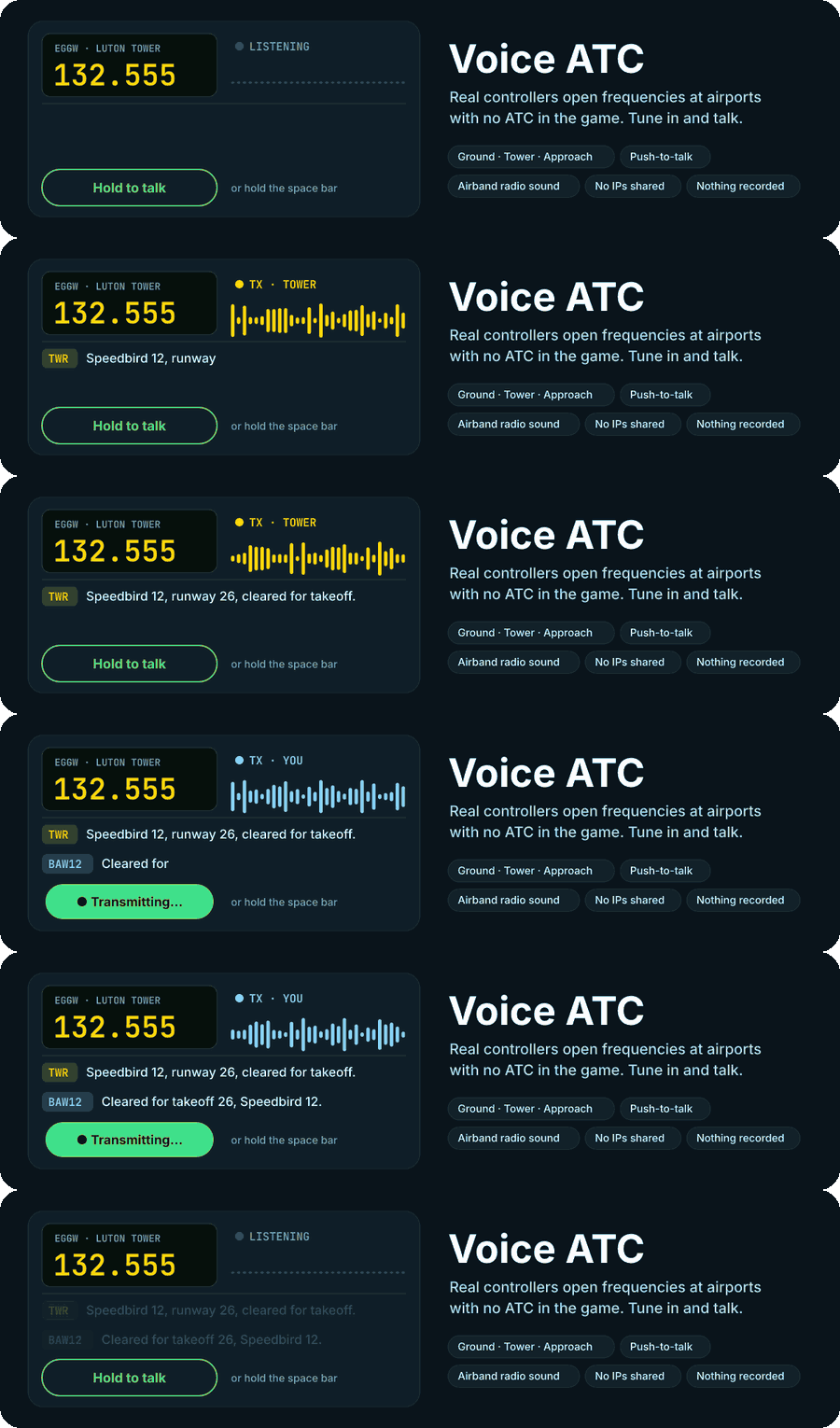
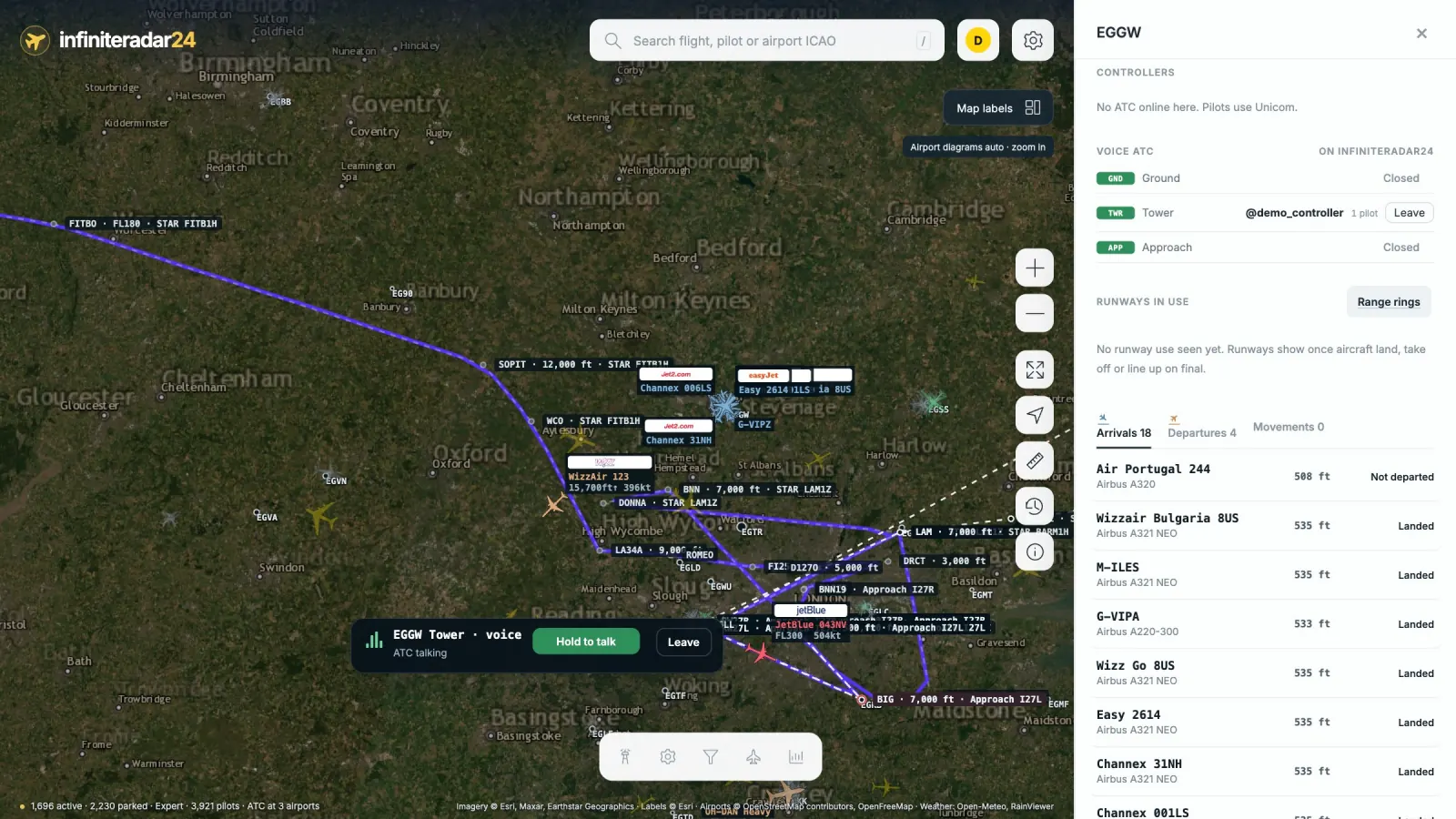
- At airports with no ATC in the game, certified controllers (IFATC, or anyone with an ATC rank) can open Ground, Tower or Approach as a voice frequency on infiniteradar24.
- Pilots tune in from the airport page or the ATC panel, hear the controller with a real airband radio sound, and reply with push-to-talk (hold the button or the space bar).
- One controller per position, who can see everyone on the frequency and remove anyone. The ATC panel lists every voice frequency open on the server.
- One transmission at a time, like a real frequency. Audio goes through infiniteradar24’s server, so nobody on the frequency can see your IP address, and nothing is recorded. It’s separate from the game’s own ATC.
Follow any flight in 3D
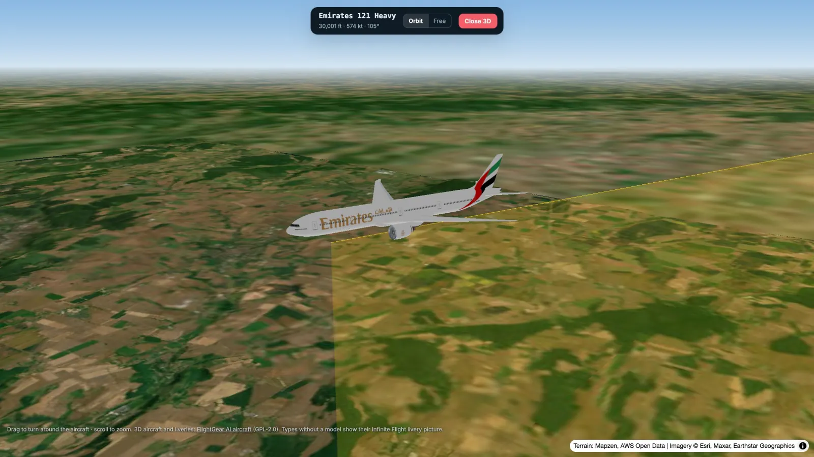
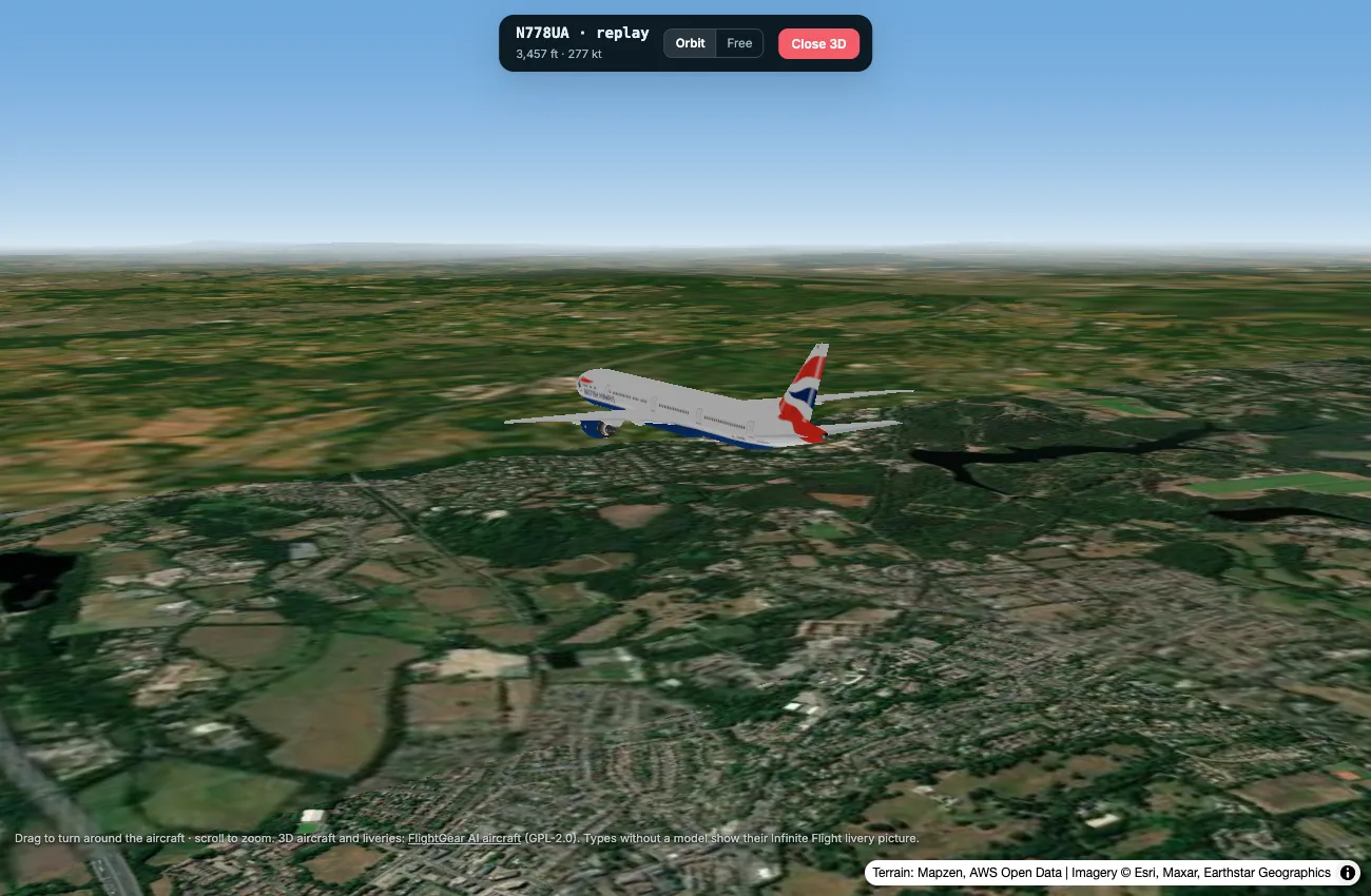
- Open View in 3D on any flight card: the aircraft flies over real terrain and satellite imagery at its actual altitude, with its trail behind it.
- Real 3D models in airline liveries for Infinite Flight’s airliners, from the A320 and 737 to the 777, 787 and A380 (a few types use the closest model, and the rest show their livery picture).
- Drag to orbit around the aircraft and scroll to zoom. The camera keeps following it, and nearby traffic flies around you.
- The landing gear comes down on approach and goes up after takeoff.
Runways in use, landings and movements
- Each airport shows the runways in use, worked out from real takeoffs, landings and aircraft lined up on final.
- A new Movements board lists every takeoff and landing with its runway and time.
- Landing rates: the descent rate just before touchdown, rated smooth, firm or hard (an estimate, since positions update every 15 seconds).
- Range rings at 10, 25, 50 and 100 nm around any airport.
Statistics
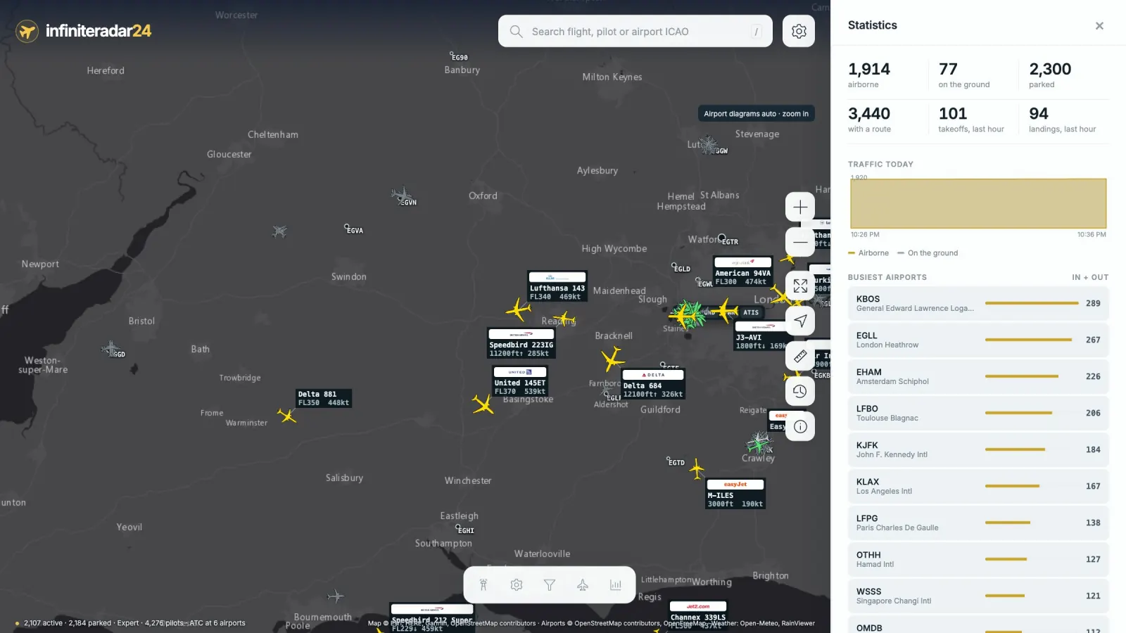
- Live totals, takeoffs and landings in the last hour, and a chart of traffic through the day.
- Busiest airports and routes, plus the most-flown airlines, aircraft types and virtual organizations, all one tap away.
- Smoothest landings of the last hour.
Fleets, routes and alerts
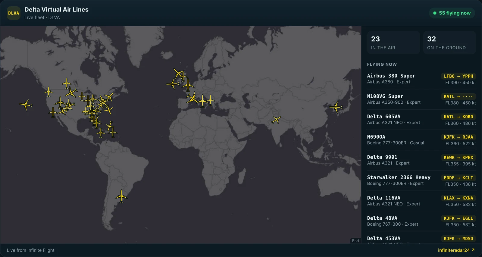
- Tap an airline, aircraft type or virtual organization to see its whole fleet in the air, broken down by type, with every flight’s route.
- Route search: type
EGLL-KJFK(orLHR JFK) to find everyone flying between two airports. - Custom alerts: get notified when an airline or aircraft type takes off or lands, when traffic arrives at or leaves an airport, or when ATC opens there.
Rewind with playback
- Missed something? Rewind up to two hours of traffic and play it back at 30×, 60× or 120×.
Make it yours
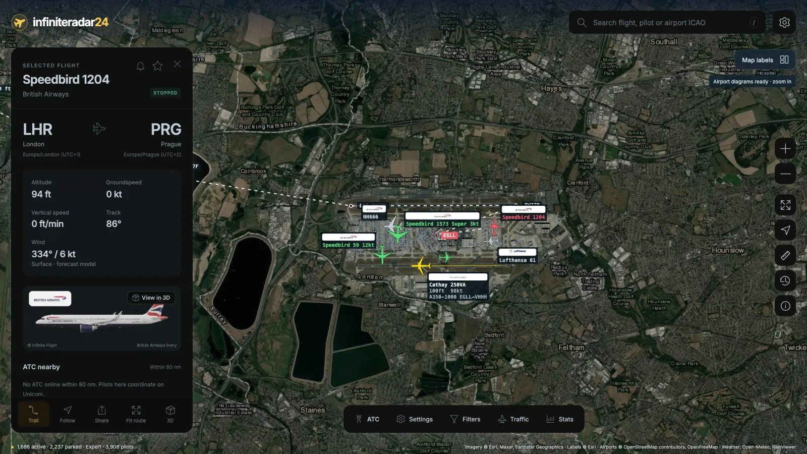
- Dark interface for panels and flight cards (or follow your device), with liveries and logos kept in their real colours.
- Units and time: feet or metres, knots or km/h, and local time or UTC, everywhere in the app.
- Custom labels: choose what each aircraft’s label shows (altitude, speed, aircraft type and route).
- Trails behind every aircraft, coloured by altitude.
- Landing alerts: tap the bell on any flight to be notified when it lands.
- Saved places: save airports and map views to jump back in one tap, and every link you copy reopens exactly what’s on screen.
More on the map
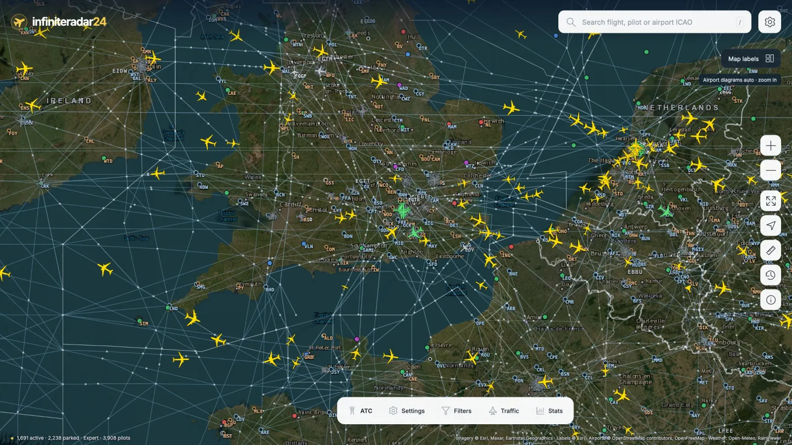
- Airport weather at a glance: every airport coloured by its real-world flight conditions (VFR, MVFR, IFR, LIFR), with the METAR on hover.
- Navaids and airways: VORs and NDBs as you zoom in, and the airways and fixes between them further in.
- Flight information regions outlined across the world.
Smarter traffic
- Holding patterns are detected automatically: holding aircraft get a ring on the map, and each airport lists who’s in the hold.
- Go-arounds and diversions (landing somewhere other than the filed destination) show up on the airport’s Movements board and on the flight card.
- Aircraft now glide smoothly across the map, up to 60 times a second when you’re zoomed in.
And a few more
- Center coverage: when a Center is open, its whole region is shaded on the map.
- Measuring tool for distance and bearing between any points.
- Export any flight’s trail as KML for Google Earth (with altitude) or CSV.
- Altitude and speed chart on every flight card, with a readout as you hover.
- Keyboard shortcuts for everything (press
?), and the site can be installed like an app on your phone or computer.
New for launch
Community events, live
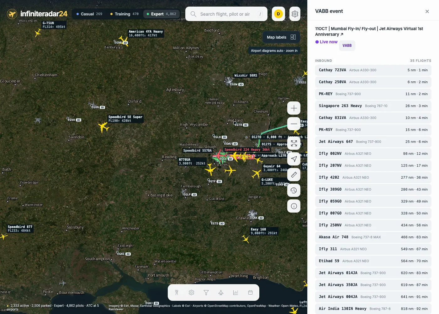
Every fly-in, fly-out and VA event from the Infinite Flight Community’s Events category shows on the map as an EVENT badge at its airport (it pulses while the event is on). Open one for its live page: everyone inbound with their ETA, the final approach queue, the arrival rate, and the smoothest landings of the event.
Landing leaderboards
The smoothest landings of the last 24 hours or 7 days, on any server, at any airport, and per event. Every night the  Butter of the day is posted on Discord.
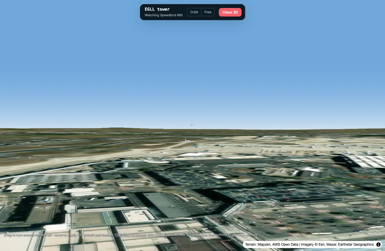
Tower view and landing replays in 3D
Climb into any airport’s tower: the camera watches the nearest arrival, departure or aircraft taxiing. And any landing on the Movements board can be replayed in 3D, following the aircraft down the approach.
Your logbook
Once you’ve signed in, every flight you land is saved in My logbook: route, times, distance, aircraft and landing rate, with a replay of the whole flight on the map.
Notifications on your phone
Turn on notifications in Traffic › Alerts and get them even when infiniteradar24 is closed: a flight you watch has landed, a starred pilot came online or took off, or one of your alerts fired. New spotting alerts too, like “A380 at EGLL”, plus a Spotted collection of every type and livery you’ve opened.
For controllers
Each airport shows a traffic forecast: arrivals in the next 30 and 60 minutes, the busiest 10 minutes, and the runway the real-world wind favours. The weather now includes the TAF and a SIGMET layer (thunderstorms, turbulence, icing, volcanic ash).
For virtual airlines
Every VA and VO gets a live fleet widget for its own website: its aircraft on a map, who’s flying and its best landings. Copy the code from your organization’s page on infiniteradar24.
Also new
- Airport diagrams in the satellite style, with runway numbers at the thresholds, taxiway names and airline logos on the aircraft at their stands.
- Link previews: share
/f/BAW202on Discord or here and it shows the flight’s route, altitude and speed. - En français : l’interface suit la langue de votre navigateur (Settings › Language).
- A faster map: aircraft are drawn with WebGL, smooth even with 5,000 aircraft on Expert.
Share any flight
- Every flight has a short link like
/f/BAW202: send it to a friend and it opens straight onto that aircraft, on whichever server it’s flying. - Copied links reopen exactly what’s on screen (airport, panel, map view), without anything personal in them.
Private and secure
- Encrypted on top of HTTPS: everything the radar loads (flights, airports, pilot profiles, liveries and logos) and every voice ATC transmission is sealed with a key unique to your session, so even your browser’s network panel only shows unreadable data. The key itself is never sent over the network.
- On voice ATC, nobody can see anyone’s IP address, and nothing is recorded.
- Your bookmarks, alerts and settings stay in your own browser.
- Sign out everywhere in one tap ends your session on every device.
Sign in with your Infinite Flight account
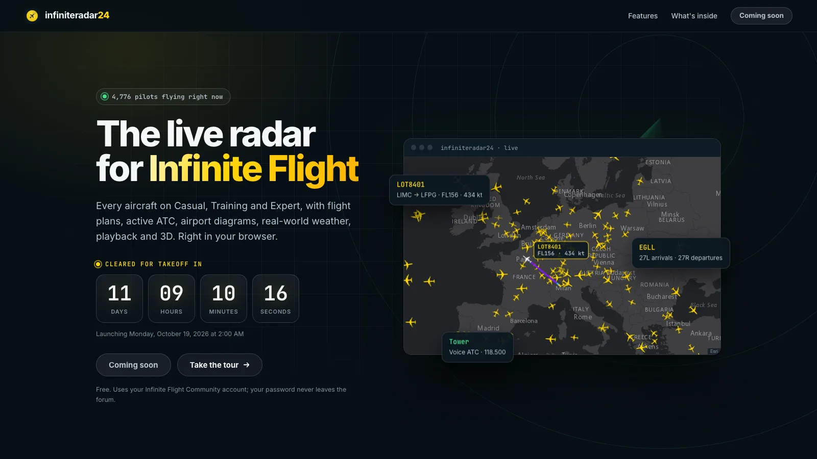
infiniteradar24 has its own home page: live traffic over Europe, a real FlightGear 777 in 3D, Heathrow drawing itself with aircraft taxiing, and the countdown to launch. The radar opens once you sign in with your Infinite Flight Community account. You approve infiniteradar24 on the forum, and it never sees your password. Signed in, your own aircraft is highlighted on the map and your profile is one tap away.
Launch: 19 October 2026, 00:00 UTC
infiniteradar24.onrender.com opens to everyone the moment the countdown hits zero, with no waiting list and nothing to install. 
Join the Discord
 Launch news and updates first, with a launch event you can mark as Interested for a reminder
 Bug reports and
 feature requests, where you can upvote what you want next
 Group flights and fly-ins, and
 spotting from the radar
 Voice ATC: controllers coordinate where they’re opening, and there’s a practice channel for phraseology
 The infiniteradar24 bot:
/flight BAW202,/airport EGLL,/eventsand/leaderboard, right in the chat Butter of the day and live event posts, every day
Until launch I’d love your feedback, here or on Discord:
- What do you use a radar for in IF: spotting, events, ATC, following friends?
- What would you want in the first version?
- Anything that would make it useful for IFATC or virtual organizations?
Thanks for reading, and see you on the radar!
Note: I wanted to post this in ThirdParty, but creating a topic there requires trust level 2 and I’m not there yet, so I’m sharing it here. Moderators, feel free to move it to the right category. 

Map data © Esri, HERE, Garmin, OpenStreetMap contributors. Airport layouts © OpenStreetMap contributors via OpenFreeMap. Weather: Open-Meteo, RainViewer, aviationweather.gov (METAR). Runway and navaid data: OurAirports. Airways: FlightGear navigation data (GPL-2.0). Center regions: VATSpy Data Project (CC BY-SA 4.0). 3D terrain: Mapzen / AWS Terrain Tiles. 3D aircraft and liveries: FlightGear AI aircraft (GPL-2.0).


